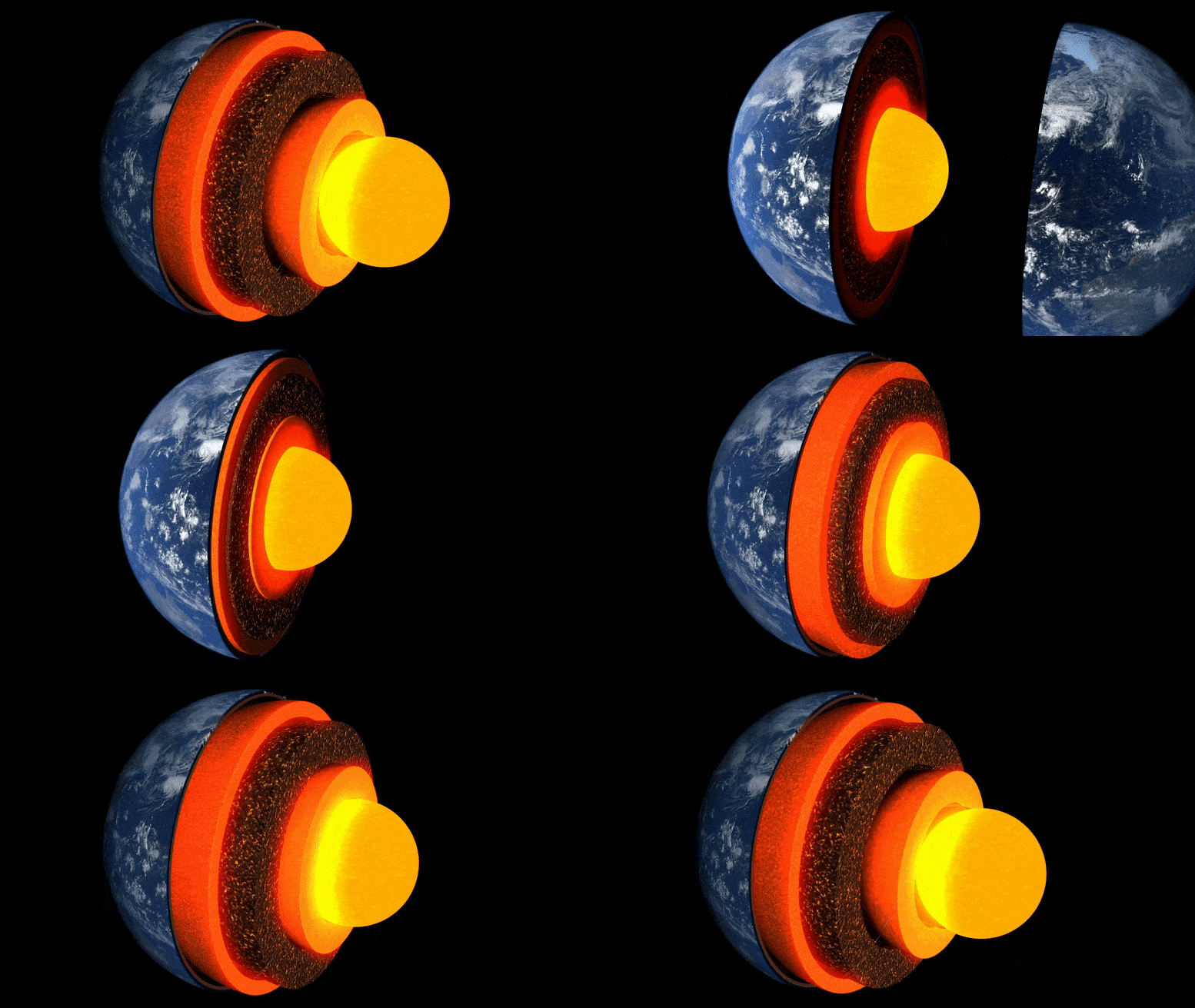
Dünya’nın katmanlarının animasyonu.
Cambridge Üniversitesi tarafından yürütülen yeni araştırma, yüzeyin yaklaşık üç bin kilometre altında, Dünya’nın çekirdeğiyle sınır tabakasındaki olağandışı bir kaya cebinin ayrıntılı bir “görüntüsünü” elde eden ilk araştırma oldu.
Hawai Adaları’nın hemen hemen altında bulunan gizemli kaya bölgesi, çok düşük hıza sahip birkaç bölgeden biridir – deprem dalgaları, içinden geçerken yavaşlarlar.
19 Mayıs 2022’de dergide yayınlanan araştırma Doğa İletişimibu ceplerden birinin karmaşık iç anizotropisini ayrıntılı olarak ortaya koyan, Dünya’nın derinliklerinin manzaralarına ve bunların içinde işleyen süreçlere ışık tutan ilk kişidir.
“Dünyanın tüm derin içsel özellikleri arasında en harika ve karmaşık olanı budur.” – benim gibi
Doktora öğrencisi olan baş yazar Zhi Li, “Dünya’nın tüm derin iç özellikleri arasında en büyüleyici ve karmaşık olanı bu. Şimdi iç yapısını gösteren ilk somut kanıtı elde ettik – derin sismolojide gerçek bir dönüm noktasıdır” dedi. Cambridge’deki Yer Bilimleri Bölümü’nde. zemin”.
Dünyanın içi bir soğan gibi oluşur: merkezde manto olarak bilinen kalın bir tabaka ile çevrili demir-nikel çekirdek ve bunun üzerinde üzerinde yaşadığımız ince bir dış kabuk – üzerinde yaşadığımız kabuk. Manto katı bir kaya olmasına rağmen, çok yavaş akacak kadar sıcaktır. İç konveksiyon akımları, ısıyı yüzeye besler, tektonik plakaların hareket etmesine ve volkanik patlamalara neden olur.
Bilim adamları, Dünya yüzeyinin altında ne olduğunu “görmek” için depremlerden gelen sismik dalgaları kullanırlar – bu dalgaların yankıları ve gölgeleri, derin iç kısımların radar benzeri görüntülerini ortaya çıkarır. Ancak yakın zamana kadar, gezegenimizin iç ısı akışını incelemek için birincil ilgi alanı olan çekirdek-manto sınırındaki yapıların “görüntüleri” grenli ve yorumlanması zordu.

Bu çalışmada kullanılan Sdiff ışınlarının olayları ve yörüngeleri. a) 1D PREM Dünya modeli için 96°, 100°, 110° ve 120°’de Sdiff dalgaları için ışın yörüngelerini gösteren, Hawaii’deki ultra düşük hız bölgesinin merkezinden geçen bir kesit. Yukarıdan aşağıya kesik çizgiler 410 km, 660 km ve 2.791 km (çekirdek-manto sınırının 100 km üzerinde) süreksizlikleri gösterir. b) 2791 km derinlikte arka plan tomografi modeli SEMUCB_WM1 üzerindeki olaylar ve Sdiff ışını yörüngeleri. 20100,320 (sarı), 20111214 (yeşil), 20120417 (kırmızı), 20180910 (mor), 20180518 (kahverengi), 20181030 (pembe), 20161122 (gri), istasyonlar (üçgenler) dahil olmak üzere farklı renklere boyanmış etkinlikler için plaj topları , ve ışınları. Bu çalışmada kullanılan alt mantoda 2791 km’lik bir delik derinliğinde Sdiff dalga yörüngeleri. Kısa dönem analizinde kullanılan olay sarı renkle vurgulanır. Önerilen ULVZ konumu siyah bir daire içinde gösterilir. Kesikli çizgi A’da çizilen kesiti göstermektedir. Credit: Nature Communications, DOI: 10.1038/s41467-022-30502-5
Araştırmacılar, çekirdek-manto sınırındaki kilometre ölçekli yapıları tespit etmek için son teknoloji sayısal modelleme yöntemlerini kullandılar. Çalışma sırasında yöntemleri geliştiren ortak yazar Dr. Kuangdai Leng’e göre,[{” attribute=””>University of Oxford, “We are really pushing the limits of modern high-performance computing for elastodynamic simulations, taking advantage of wave symmetries unnoticed or unused before.” Leng, who is currently based at the Science and Technology Facilities Council, says that this means they can improve the resolution of the images by an order of magnitude compared to previous work.
The researchers observed a 40% reduction in the speed of seismic waves traveling at the base of the ultra-low velocity zone beneath Hawaii. This supports existing proposals that the zone contains much more iron than the surrounding rocks – meaning it is denser and more sluggish. “It’s possible that this iron-rich material is a remnant of ancient rocks from Earth’s early history or even that iron might be leaking from the core by an unknown means,” said project lead Dr Sanne Cottaar from Cambridge Earth Sciences.

Conceptual cartoons of the Hawaiian ultra-low velocity zone (ULVZ) structure. A) ULVZ on the core–mantle boundary at the base of the Hawaiian plume (height is not to scale). B) a zoom in of the modeled ULVZ structure, showing interpreted trapped postcursor waves (note that the waves analyzed have horizontal displacement). Credit: Nature Communications, DOI: 10.1038/s41467-022-30502-5
The research could also help scientists understand what sits beneath and gives rise to volcanic chains like the Hawaiian Islands. Scientists have started to notice a correlation between the location of the descriptively-named hotspot volcanoes, which include Hawaii and Iceland, and the ultra-low velocity zones at the base of the mantle. The origin of hotspot volcanoes has been debated, but the most popular theory suggests that plume-like structures bring hot mantle material all the way from the core-mantle boundary to the surface.
With images of the ultra-low velocity zone beneath Hawaii now in hand, the team can also gather rare physical evidence from what is likely the root of the plume feeding Hawaii. Their observation of dense, iron-rich rock beneath Hawaii would support surface observations. “Basalts erupting from Hawaii have anomalous isotope signatures which could either point to either an early-Earth origin or core leaking, it means some of this dense material piled up at the base must be dragged to the surface,” said Cottaar.
More of the core-mantle boundary now needs to be imaged to understand if all surface hotspots have a pocket of dense material at the base. Where and how the core-mantle boundary can be targeted does depend on where earthquakes occur, and where seismometers are installed to record the waves.
The team’s observations add to a growing body of evidence that Earth’s deep interior is just as variable as its surface. “These low-velocity zones are one of the most intricate features we see at extreme depths – if we expand our search, we are likely to see ever-increasing levels of complexity, both structural and chemical, at the core-mantle boundary,” said Li.
They now plan to apply their techniques to enhance the resolution of imaging of other pockets at the core-mantle boundary, as well as mapping new zones. Eventually, they hope to map the geological landscape across the core-mantle boundary and understand its relationship with the dynamics and evolutionary history of our planet.
Reference: “Kilometer-scale structure on the core–mantle boundary near Hawaii” by Zhi Li, Kuangdai Leng, Jennifer Jenkins and Sanne Cottaar, 19 May 2022, Nature Communications.
DOI: 10.1038/s41467-022-30502-5


More Stories
Yeni bir okyanus atlası, yapay ışığın geceleri denizleri nasıl kirlettiğini gösteriyor
NASA’nın Webb Uzay Teleskobu, Kayalık Gezegen Oluşumu bölgesinde su buharı tespit etti
Ölü bir balinanın leşiyle beslenen düzinelerce köpekbalığını izleyin: ScienceAlert